Berkeley Bayside Stroll
Other
80 Bolivar Drive,Berkeley CA 94710
20 August, 2022
Description
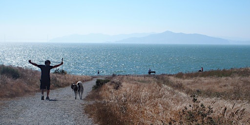
We'll share the history and evolution of the park, as well as the many ways Berkeley's waterfront areas provide habitat for wildlife and recreation for people. Along with panoramic vistas, we'll view birds, sailboats, houseboats, kites, and more—all along fairly level terrain. Leader Bob Johnson Total Distance This is a moderate walk of 5.7 miles round trip with minimal (70 feet) elevation change. Weather Policy Rain cancels Cost Free, but reservations required Where to Meet We will meet where Addison Street ends at Bolivar Way in Berkeley’s Aquatic Park. If coming by car on I-80, exit at University Avenue heading east, turn right at 6th Street, and right again after one block onto Addison. Continue past the railroad tracks to Bolivar Drive. Parking is generally available along Bolivar Drive but check signage for any limitations. By public transit, take the AC Transit 51B bus from downtown Berkeley or other locations. Get off at 4th Street, cross left under the University Avenue overpass and go right on Addison Street, and continue across the railroad tracks to Bolivar Drive. Notes Bring water, snacks, and lunch. Dress in layers and wear good walking shoes. If you have questions about this outing, please email Ken Lavin at [email protected] or phone (415) 543-6771 x321. Photo: Bob Johnson About the Outing LeaderBob Johnson recently retired after serving for 30 years as a Greenbelt Alliance Board member. He has also worked with Urban Advantage to produce photo-realistic visualizations of better urban design. Previously, he worked for many years as a securities analyst in Japan as well as the Bay Area. With Janet Byron, he co-wrote the book Berkeley Walks featuring self-guided urban tours.
Discussion
By posting you agree to the Terms and Privacy Policy.