Will Tropical Storm Fred Flood? Cable Company And Hoboken Prepare
News
Hoboken NJ
18 August, 2021
10:59 AM
Description
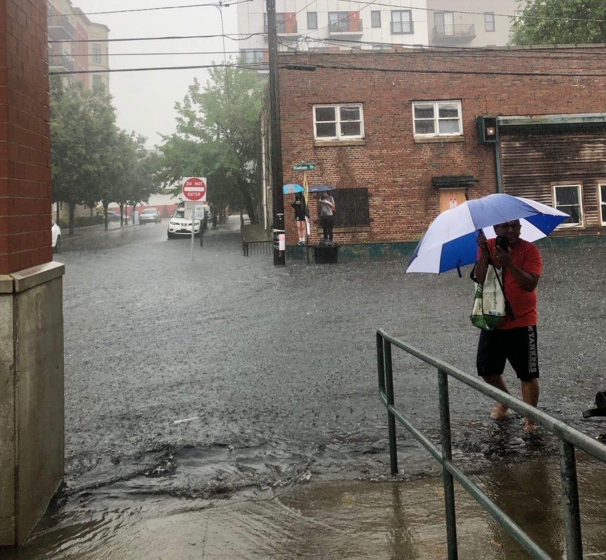
HOBOKEN, NJ — Hoboken residents and the area's cable company prepared for rain Wednesday night into Thursday from the remnants of Tropical Storm Fred. Since Fred has been traveling over land, it's not expected to bring as much rain as did Tropical Storm Elsa last month, but forecasters say rain could cause flash flooding, particularly early Thursday. "Locally heavy rainfall from the remnants of Fred may bring localized flash flooding late tonight into Thursday morning," the National Weather Service said for the area. "An isolated tornado is also possible." Low-lying areas of the city of Hoboken flooded twice last month during heavy downpours, and trapped shoppers in a ShopRite parking lot. READ MORE: Flash Flood Traps Shoppers In Hoboken Lot: It Happened That Fast While some may consider flash floods just an inconvenience, these floods have proved fatal to drivers (sometimes trapping parents and children) and people near even small streams. The forecast for the Hoboken area says: Wednesday: A slight chance of showers between noon and 2 p.m., then a slight chance of showers and thunderstorms after 2 p.m. Mostly cloudy, with a high near 85. Southeast wind 6 to 10 mph. Chance of precipitation is 20 percent.Wednesday Night: A chance of showers and thunderstorms, then showers and possibly a thunderstorm after 11 p.m. Some of the storms could produce heavy rainfall. Low around 74. Southeast wind 8 to 10 mph. Chance of precipitation is 80 percent. New rainfall amounts between a quarter and half of an inch possible.Thursday: Showers and possibly a thunderstorm before 8 a.m., then a chance of showers and thunderstorms after 8 a.m. Some of the storms could produce heavy rainfall. High near 87. West wind around 10 mph. Chance of precipitation is 80 percent. New rainfall amounts between a tenth and quarter of an inch, except higher amounts possible in thunderstorms.Thursday Night: A 20 percent chance of showers before 2 a.m. Mostly cloudy. Here is Patch coverage: Tropical Depression Fred To Bring Thunderstorms, Heavy Rain To NJ See the National Hurricane Center's rainfall potential map here. Click the most up-to-date forecast here. List Of Streets That May Flood In Hoboken Storms Last month, before severe storms, the city of Hoboken released the information below. Note that as of this writing, the city and Hudson County have not released an advisory about the remants of Fred. This is previous storm guidance: Residents should secure all furniture and loose objects outside or bring them inside, especially on balconies. Outdoor tents should be taken down depending on wind load.Damaging winds could blow down trees and power lines, resulting in power outages. Please report power outages and downed wires to PSEG at https://nj.myaccount.pseg.com/....Do not park in or drive through flooding prone areas. Sometimes, the city's OEM posts no parking signs and cars may be towed from those areas. These intersections include: 1st and Marshall1st and Harrison2nd and Harrison3rd and Harrison4th and Harrison4th and Monroe3rd and Jackson4th and Jackson9th and Monroe9th and Madison10th and Madison1st and Clinton3rd and ClintonHenderson and NewarkGrove and Newark Please report flooded intersections and clogged drain inlets by calling the NHSA Hotline at 866.689.3970. More Information From The City Review the Hoboken Ready website and flyer available in English and Spanish. Learn how Hoboken and NHSA prepare for, respond to, and recover from intense rainfall storms. Learn about Hoboken's efforts to mitigate rainfall flooding. Famous Floods In Recent Hoboken History Before Tropical Storm Elsa, the city suffered several other 50-year storms. READ MORE: July Flood Was Another 50-Year Storm Severe storms are becoming more frequent. In fact, the current Hurricane Elsa was the earliest E-named storm in modern weather history. Cable Company Guidance On Tuesday, the local cable company for the Hudson County area, Optimum, released guidance: "With Tropical Storms Fred, Grace and Henri making their way up the coast, we want to remind you of the resources available to you and assure you we are prepared for storm-related outages. "While some outages cannot be prevented as they're caused by downed wires and power lines, our fully staffed teams are standing by to assist our customers if there are any storm-related outages as soon as it is safe to do so. If unpreventable service outages do occur, restoring your Optimum service is always our top priority. We have made sure that our generators are checked and ready in case of any extended power outages." How you can prepare:• Have all your devices charged and ready.• If you haven't yet signed up for text message alerts, do it now so you get the latest information right to your phone. Sign up for text message alerts.• Have your Optimum ID ready so you can quickly log in to your account, check for service status updates, and find online support. • Don't have an Optimum ID? Create One • Can't remember your Optimum ID or password? Get a reminder• Make sure your profile is up to date: • Verify contact information and enroll in "Service Alerts" on the My Profile page • Add important email accounts to mobile devices and tablets using these easy-to-follow instructions; Apple Devices, Samsung Devices.• • Follow us on Social Media: • Twitter – @OptimumHelp • Facebook – Optimum Want breaking news when it happens in Hoboken? Sign up for occasional breaking news alerts, and/or get a free daily newsletter at 6 a.m. each morning with Hoboken news. Sign up with your preferences here. Got news? Email [email protected]. Got photos? Please include express written permission from the photographer for us to use them. To be the first to get free news alerts with breaking stories in your town, or to get a free local newsletter each morning, sign up for Patch breaking news alerts or daily newsletters.
Discussion
By posting you agree to the Terms and Privacy Policy.